Photo above: Jefferson Memorial. Right: Cuban Embassy in Washington, D.C., 2016. Courtesy Wikipedia Commons.
Sponsor this page for $100 per year. Your banner or text ad can fill the space above.
Click here to Sponsor the page and how to reserve your ad.
-
Timeline
Detail - 2010
April 1, 2010 - The U.S. Census of 2010 is conducted, showing a 9.7% increase from the 2000 census for a total of 308,745,538 people. The geographic center of the population is now 2.7 miles northeast of Plato, Missouri.

A national requirement and tradition since the first census in 1790, the 2010 census was the 23rd held in the United States. It enumerated the amount of people in the United States as of April 1, 2010. There were approximately 134 million forms sent out by the department. The forms were among the shortest in history, with only ten questions asked. Seventy-four percent of them were returned, prompting census takers, six hundred and thirty-five thousand of them, to track down the rest.
The top state by population was California, with 37,253,956, a 10% increase. It was followed by Texas, with 25,145,561, a 20.6% increase. The least populated state was Wyoming with 563,626, even below that of the District of Columbia.
Per the changes in Metropolitan regions, i.e. cities and their surrounding suburbs, in the 2010 census, the New York Metropolitan area still leads the way with 19,567,410 people counted in the census. It was followed by Los Angeles, Chicago, Dallas-Ft. Worth, and Philadelphia.
There were slight differentiations when ranking cities by the city itself and not the Metropolitan areas. New York still remained atop the list with 8,175,133 residents, followed by Los Angeles, Chicago, Houston, and Philadelphia. Thirty-three cities now had over 500,000 residents.

Impact on Politics
As each census controls the amount of Congressmen and Congresswomen in the U.S. House of Representatives, per the next election cycle, as well as the weight of Electoral Votes in the next Presidential election, the impact on politics is often huge.
For the 2010 census, there were eighteen changes in representation. With population moving, in general, to the south and west, Texas gained four seats, Florida gained two seats, and the states of Arizona, Georgia, Nevada, South Carolina, Utah, and Washington each gained one. Washington State was the only northern state to gain in population, rising 830,419 people to a total of 6,724,540.
For those on the other side of the ledger, New York and Ohio lost two seats. The states which lost one seat each were Illinois, Iowa, Louisiana, Massachusetts, Michigan, Missouri,
New Jersey, and Pennsylvania. Louisiana was the only southern state to lose population, gaining only 64,396 people for a total of 4,533,372. That 1.4% gain was much lower than the average gain of the nation in total at 9.7% increase. Some of Louisiana's problem was due to the exodus prompted by the devastation of Hurricane Katrina in 2005.

Plato, Missouri
In March 2011, Plato, Missouri, with a population of 109, was declared the 2010 mean center of United States population based on the 2010 census. The mean center of each recent census since 1980 had been moving southwest through Missouri twenty to thirty miles each ten years.
The village, in 2010, had forty-one households and thirty-five families. It was 95.4% White, 4.6% Hispanic, 1.8% African American, 1.8% Native American, and 0.9% from other races. The total above 100% reflects multiple racial heritage amongst the population.
The community was founded in 1874, is currently located in Texas County, Missouri, and is named after Greek philosopher Plato. The population decreased by the 2020 census to 82 people.
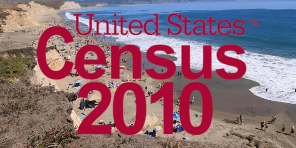
Photo above: Montage (Overlay) Official logo for the 2010 Census, 2010, U.S. Government. Courtesy Wikipedia Commons. (Background) Drakes Beach scene at Point Reyes National Seashore in the most populous state, California. Source: National Park Service. Photo below: High School sign in Plato, Missouri, the mean center of the U.S. Census, 2011, Maurina/Pulaski County Daily News MilitaryFan. Courtesy Wikipedia Commons. Info source: National Park Service; U.S. 2010 Census, Census Bureau; Wikipedia Commons.


