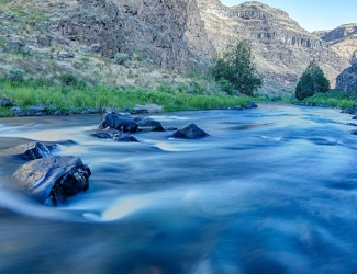
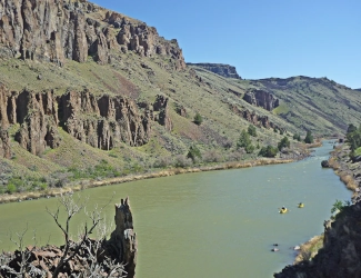
Image above: Isn't that the bluest water you've ever seen. Its part of Owyhee Wild and Scenice River. Courtesy Bureau of Land Management.
Spotlight on Lesser Known History
Owyhee Wild and Scenic River
Idaho, Oregon.
America's Best History Spotlight
On this page we're going to Spotlight the lesser known historic sites and attractions that dot the history landscape across the USA and are worth a visit if you're in their area. And while they may be lesser known, some are very unique, and will be that rare find. You'll be, at times, on the ground floor, or maybe even know something others don't. It'll be fun. Visit them.
Owyhee Wild and Scenic River, Idaho, Oregon.
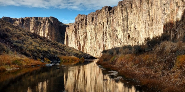
Stretching one hundred and twenty miles across two states, the Owyhee National Wild and Scenic River, with dam, has seen nature making river canyons since the dawn of time, and rafters on rapids and placid river stretches since the times of man. Now a dedicated National Wild and Scenic river since 1984, and Wilderness, since the Obama Administration, it is being mentioned for an upgrade in status, perhaps to a National Monument. But whether that comes or not, this park, river, and land managed by the Bureau of Land Management (BLM) is a wondrous site to visit and create your own adventure on the river, on its banks for hiking, or for a weekend camp experience.
Image above: The Owyhee River weaving through canyon walls. Courtesy BLM.
Sponsor this page. Your banner or text ad can fill the space above.
Click here to Sponsor the page and how to reserve your ad.
Info, What's There Now, History Nearby
Owyhee Wild and Scenic River
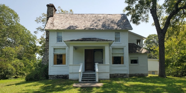
While the Owyhee River was included in the National Wild and Scenic River System in 1984, it was during the Obama Administration that the Wilderness Areas in the high basalt plateaus of Idaho were protected on March 30, 2009. The River is a tributary of the Snake River; it runs from its headwaters in Elko County, to the north of the Great Basin in Nevada. The area was inhabited by the Shoshone and Bannock, but its name is a derivative of the word Hawaii, given to it in reference to Hawaiian trappers when they were part of the old North West Company in 1819. Three Hawaiian Kanakas went on an exploration trip and never came back. It was assumed the were killed by one of the Native American tribes, the Bannock, under chief "The Horse."
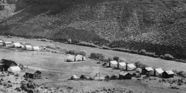
Gold and silver were discovered here in 1863 along the Jordan Creek, causing a typical gold rush. Evidence of this now in the area has disappeared for the most part. The Owyhee Dam was constructed in 1933 to provide irrigation to the area.
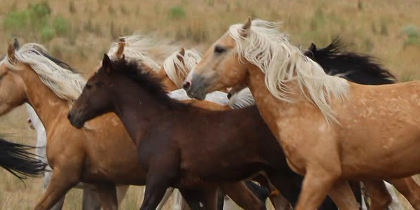
Image above: Old campsite along the Owyhee River. Courtesy Bureau of Land Management. Below: Wild horses in an Owyhee National Herd Management Area. Courtesy BLM.
Where Is It
Since the National Wild and Scenic River is spread over one hundred and twenty miles and two states (okay three, including Nevada, but not technically in the named park), there are many access points. Check their map on the Bureau of Land Management home page. Its main address for their headquarters is the Vale District Office, 100 Oregon Street, Vale, Oregon 97918. One access point is located outside Rome, Oregon; East on US-95 across the Owyhee River, then South on the first graveled road after less than half a mile. The Rome Launch Site is on the river shortly down that road; a visitor reception area is located here within the BLM Office and Bunkhouse.
VIDEO SHORT - Owyhee Wild and Scenic River
Watch this short of the natural history of the Owyhee National Wild and Scenic River in photos of the Owyhee River and canyonlands that rise above it.
What is There Now
Owyhee Wild and Scenic River
Most of the scenic river area is full of campgrounds, river access, and hiking opportunites. Add that to the historic ranches, including the Hole in the Ground, Birch Creek, and Morrison Pinnacle Ranches, which have historic buildings, but limited signage, and you have the escence of what visiting the Owyhee River is all about. There are a few interpretation and visitor stations, including that at the Rome Boat Launch site; these are staffed when staff is available, so don't count on that if you are camping or visiting.
When Open and How Much
The wilderness and nature of the Owyhee National Wild and Scenic River are open year round, but be careful in winter or bad weather when visitation may have limited resources. Visitor contact stations are open on a staff available basis. The sites are free to visit.
Fees and hours are subject to change.
Websites
Owyhee Wild and Scenic River
Visit Idaho
Travel Oregon
History Nearby
The history nearby has ties to many natural history sites, as well as a great lodge that will amazing.
Photos, History, and More Spotlights
Recreational Activities
There are so many here that will peak the interest of those in your group, whether you like native history (one hundred prehistoric campsites), European migration history (Hole in the Ground, Birch Creek, and Morrison Pinnacle Ranches), or the more active kind; hiking, boating, camping for up to fourteen days on sites all along the one hundred and twenty-miles of the Scenic River, fishing, biking, horseback riding, and viewing the copious amounts of wildlife that inhabit the river banks and skies.
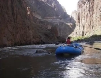
Photo above: Rafting through the canyons. BLM.
T-Shirts and Souvenirs

America's Best History T-Shirts, Sweatshirts, Backpacks, and other Souvenirs from the official gear of americasbesthistory.com.
Owyhee Wild and Scenic River
This is the land of vertical canyons with rhyolite cliff faces and hoodoos; they reach nearly one thousand feet in height near the Oregon border. It is known as the "Grand Canyon of the Owyhee" near the west end of the river where it meets the South Fork Owyhee River. In southwestern Idaho, the Owyhee Canyonlands Wilderness is an oasis of solitude, as few people visit this area. It is remote and rugged, but huge, think two hundred and sixty seven thousand acres. In Nevada, desert highlands host packs of wild horses, decendents from the ranches, in Herd Management Areas.
The North Fork Owyhee Wilderness area is another location to visit its forty-three thousand acres. It is home to beautiful wildflowers and bighorn sheep.
In 2024, an Interpretation Assistance Program Report was concluded in an attempt to draw more visitors and enhance their experience along the Owyhee River. The findings included that while many of the ranches, some with limited access, are available to the public, there is very little interpretive signage.
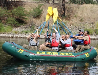
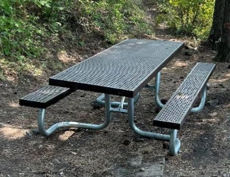
Image above: Park staff, the Owyhee River Patrol, enjoying the river. Courtesy Bureau of Land Management. Below: Picnic tables throughout the park. BLM.
Rafting on the River
Most of the rafting trips here occur in the spring when the water runs high. At other seasons of the year, there are low water excursions, but only in small craft.
Images above: View of rafters from the heights of the canyon walls. Courtesy BLM.
Buy Second Edition
America's Best History Timeline

Great book to keep middle school to college students up to date on their American history.
August Spotlight
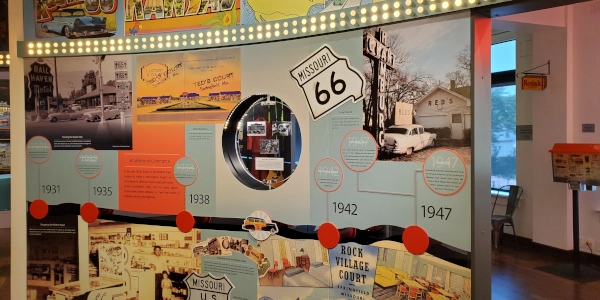
Museum on the Square, Route 66, Missouri
October Spotlight
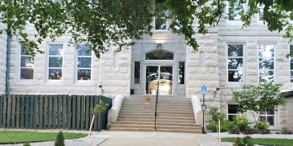
Battle of Carthage, Missouri