-
Pre-Revolution Timeline - The 1700s
Wars amongst colonial powers from Queen Anne to French and Indian led to growing unrest within the colonies themselves as taxes were levied without representation, which would lead to the next decade to come and revolution. American leaders began to emerge in a variety of ways, including George Washington trying to become a British General and Ben Franklin beginning his publishing career and flying a kite.
More 1700s


Above: First sited in 1741 by Europeans, Mount Saint Elias, 2008. Courtesy National Park Service. Right: Fort Necessity, French and Indian War.

Sponsor this page for $150 per year. Your banner or text ad can fill the space above.
Click here to Sponsor the page and how to reserve your ad.
-
Timeline
1749 Detail
March 16, 1749 - The petition of the Ohio Company to be granted two hundred thousand acres in approved by King George II of England to settle and engage in commerce in the territory of Ohio.

It was not hard to see upon the end of King George's War that the Treaty of Treaty of Aix-la-Chapelle had not really settled much within the landscape of territorial conflict between the French and the English. Yes, the French had be given back Fort Louisbourg in Nova Scotia, but the treaty did not address claims in other areas, one such Ohio and the lands west of the Allegheny Mountains. Both nations claimed it, but it was effectively unsettled. So, with its riches of trade with the Six Nations and territory sitting there to be claimed, per European motives, King George II granted permission to the government of the colony of Virginia, who had denied the original petition, for a land grant of two hundred thousand acres to a company of predominantly Virginia men, including Robert Dinwiddie, the future colonial Lieutenant Governor of Virginia, Augustus Washington, Lawrence Washington, and Thomas Lee. Yes, those Washingtons were relatives of the more famous George. Both were his half brothers with Augustus twelve years older and Lawrence, fourteen years older. Yes, Thomas Lee is related to Robert E.
It would be land speculation and trade with the Indians, in territory of today's Ohio, Pennsylvania, and West Virginia, as proposed and financed by those four men and John Hanbury, Colonel Thomas Cresap, George Mercer, John Mercer, as original members. The Washingtons and Lee had organized the company in 1748. George Mercer and John Hanbury petitioned the Lords of Trade and King George II for a grant, which was agreed to on March 16, 1749. The Virginia colony agreed on July 12, 1749 to extend the rights of the royal grant. The Ohio Company land grant would contain two parts. The first, two hundred thousand acres immediately given between the Kanawha River and the Monongahela River, in return for settlement, a fort constructed, all rent and tax free. If the Ohio Company could convince one hundred families to settle there within seven years, they would get three hundred thousand acres more.
They began to plan for the enticement of those families by providing access and viability. From 1748 to 1750, Colonel Thomas Cresap and Delaware Chief Nemacolin widened the Nemacolin Trail from Cumberland to the area of Brownsville, Pennsylvania, so that wagons could travel on it. This would later turn into what is known as Braddock's Road. Cresap also was hired to construct trading posts along the route of the Potomac through the Province of Maryland along the way. As Cresap developed the posts and roadways, Christopher Gist was sent to survey and explore the Ohio region for suitable locations for settlements.
He chose areas in today's Pennsylvania and West Virginia for the original Ohio Company families. Both men were granted sizeable estates for their contributions.
Within the first decade, the Ohio Company had forts built at Cumberland, Maryland and Brownsville, Pennsylvania. However, within that same time frame, disputes among the English, i.e. the Pennsylvania colonial government, were brewing over the land occupied, and the French were starting to occupy the Ohio Valley and Fort Duquesne, today's Pittsburgh, by 1754. The start of the French and Indian War would not be far behind, much of it spurred by the Ohio Company's land grant, forts, and settlements.
Relations with the Indians
The Ohio Company understood, fairly early, that it was imperative to have good relations with the tribes in the area they would occupy and settle. Colonel Thomas Cresap and Delaware Chief Nemacolin had a mutual understanding, with the area on the edge of the Nemacolin Trail populated with a large settlement at Logstown on the Ohio River. It had been settled by the Shawnee in 1725, with rich soil conducive to the cultivation of maize.
However, by the time of the land grant the area was becoming popular. The French had built thirty cabins overlooking the town in 1747, giving them to the natives after construction. The colony of Pennsylvania also arrived the next year, with the ambassador to the Six Nations, Conrad Weiser, holding a council with the chiefs. The French continued to come, sending three hundred soldiers in 1749 under New France orders and commander Pierre-Joseph Ce'loron de Bienville. He tacked copper plates on the trees, marking it New France territory, and upon arriving at Logstown, encountered British traders. They were thrown out, which offended the Iroquois.
The British, with the Ohio Company claims to their territory granted by the King, arrived on May 28, 1752, at Logstown, to council with the Six Nations about their claims. Represented by Christopher Gist, accompanied by two members of the Virginia colony, they met with Tanacharison, the Iroquois sachem. The chief did not agree that a previous treaty, the 1744 Anglo-Iroquois Treaty of Lancaster, had given the English any land beyong the Alleghenies. He would not, however, disagree with settlement southeast of the Ohio River, and agreed to a fort at the head of the Monongahela River. That fort, Fort Prince George, would be destroyed in 1754 by the French, replaced by Fort Duquesne.

Peitition for the Royal Grant, Mercer Papers
That your petitioners, for these great and national ends and purpose, and in order to improve and extend the British trade amongst the Indians, and to settle these countries in so healthy and fine a climate, and which are your Majesty's undoubted right, have entered into partnership, by the name of the Ohio Company, to settle the lands to the west of the said mountains, and to carry on a trade with the Indians in those parts, and upon the said lakes and rivers; but, as effecting the same, and more especially the erecting a sufficient fort, and keeping a garrison to protect the infant settlement, will be attended with great expense; Your petitioners, who are the first adventurers in this beneficial undertaking, which will be so advantageous to the crown, in point of revenue, to the nation in point of trade, and to the British colonies in point of strength and security, most humbly pray; That your Majesty will be graciously pleased to encourage this their said undertaking, by giving instructions to your governor of Virginia, to grant to your petitioners and such others, as they shall admit as their associates, a tract of 500,000 acres of land, betwixt Romanetios and Buffaloes Creek, on the south side of the river Allegany, otherwise the Ohio, and betwixt the Two Creeks and the Yellow Creek, on the north side of the said river, or in such other parts, to the west of the said mountains, as shall be judged most proper by your petitioners for that purpose; and that 200,000 acres, part of the said 500,000 acres, may be granted immediately without rights, on condition of your petitioners seating, at their proper expense, an hundred families upon the lands in seven years; the lands to be granted free of quit-rents for ten years on condition of their erecting a fort, and maintaining a garrison, for protection of the settlement for that time your petitioners paying the usual quit-rents, at the expiration of the said ten years, from the date of their patents. And your petitioners farther pray, That your Majesty will be graciously pleased to send your said governor a further instruction, that as soon as these 200,000 acres are settled, and the fort erected, that 300,000 acres more, residue of the said 500,000 acres, may be granted to your petitioners, adjoining to the said 200,000 acres of land fully granted, with the like exemptions, and under the same covenants, and to give all such farther and other encouragement to your petitioners, in this their so useful and publick an undertaking, as to your Majesty, in your great wisdom, shall seem meet. And your petitioners will ever pray.
Signed, John Hanbury.
Response to Petition, March 16, 1749
This petition being referred, by the Right Honourable the Lords of the Committee of his Majesty's Council, to the Right Honourable the Lords Commissioners for Trade and Plantations, they were pleased to report as their opinion, That it would be for his Majesty's service to grant the said petitions for that, the settlement of the country lying to the westward of the great mountains, as it was the centre of the British dominions, would be for his Majesty's interest, and the advantage and security of Virginia, and the neighboring colonies, as, by means thereof, a more extensive trade and commerce might be carried on with the Indians inhabiting those parts; and it would likewise be a proper step towards checking the incroachments of the French, by interrupting part of their communication, from their lodgments upon the great lakes to the river Mississippi, by means whereof the British settlements were exposed to their incursions, and that of the Indians in their interest; which benefits would be farther extended, under the said company's proposal: and therefore his Majesty was pleased, by his instruction to the govenor of Virginia, dated March 16, 1748-9, to direct such grant or grants to be made by the said company, with such exemptions, and upon such conditions as was prayed, almost in the very terms of the petition. This instruction no sooner arrived and was made publick in Virginia, than divers persons procured orders of council for 1,350,000 acres of land, on the very day it was produced in council; among others James Patton (who had suffered the time allowed before his before-mentioned order of council to run out) procured leave, in the name of some of the persons formerly mentioned as his partners, to renew the same for 100,000 acres, and two years longer time were allowed them to compleat their surveys; copies of which orders follow.
Some of the words above have been spelled in current English terms to make them more easily readible and differ from the original.
Image above: Montage of three of the founders of the Ohio Company; (left) Lawrence Washington, 1738, possibly Gustavus Hesselius as author, Mount Vernon collection; (center) Thomas Lee, unknown author, (right) Robert Dinwiddie, unknown author, National Portrait Gallery, London. All courtesy Wikipedia Commons. Image Below: Map showing the known territory of the southern English colonies, reaching to the west of the Allegheny Mountains, 1751, Joshua Fry and Peter Jefferson. Courtesy Wikipedia Commons. Info Source: ohiohistorycentral.org; "George Mercer papers relating to the Ohio Company of Virginia," 1954, edited by Lois Mulkearn; Wikipedia Commons.

History Photo Bomb

Replica of the Walker cabin in Barboursville, Kentucky, 2009. Courtesy Wikipedia Commons. Cabin built after his European discovery of the Cumberland Gap.

Official Souvenirs
Check out the official souvenirs of America's Best History on some of the best historic sites and national parks of the United States at our partners at Teepossible.
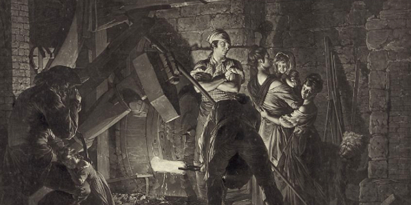
Drawing of an Iron Forge, example of one that would have been affected by the rules of England establishing the Iron Act, Boydell. Courtesy Library of Congress. Image Below: Iron Mountains in Clifton Forge, Virginia, circa 1900/1910, Detroit Publishing Company. Courtesy Library of Congress.
Timeline Book

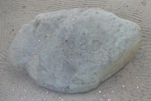
Plymouth Rock from the site of the landing of the Mayflower and start of the Plymouth Colony. Courtesy Wikipedia Commons.
ABH Travel Tip

To get a great idea of how the decades before the Declaration of Independence was written take a trip to Boston. It's a great place to learn about the colony of Massachusetts Bay, too.
It was not hard to see upon the end of King George's War that the Treaty of Treaty of Aix-la-Chapelle had not really settled much within the landscape of territorial conflict between the French and the English. Yes, the French had be given back Fort Louisbourg in Nova Scotia, but the treaty did not address claims in other areas, one such Ohio and the lands west of the Allegheny Mountains. Both nations claimed it, but it was effectively unsettled. So, with its riches of trade with the Six Nations and territory sitting there to be claimed, per European motives, King George II granted permission to the government of the colony of Virginia, who had denied the original petition, for a land grant of two hundred thousand acres to a company of predominantly Virginia men, including Robert Dinwiddie, the future colonial Lieutenant Governor of Virginia, Augustus Washington, Lawrence Washington, and Thomas Lee. Yes, those Washingtons were relatives of the more famous George. Both were his half brothers with Augustus twelve years older and Lawrence, fourteen years older. Yes, Thomas Lee is related to Robert E.
It would be land speculation and trade with the Indians, in territory of today's Ohio, Pennsylvania, and West Virginia, as proposed and financed by those four men and John Hanbury, Colonel Thomas Cresap, George Mercer, John Mercer, as original members. The Washingtons and Lee had organized the company in 1748. George Mercer and John Hanbury petitioned the Lords of Trade and King George II for a grant, which was agreed to on March 16, 1749. The Virginia colony agreed on July 12, 1749 to extend the rights of the royal grant. The Ohio Company land grant would contain two parts. The first, two hundred thousand acres immediately given between the Kanawha River and the Monongahela River, in return for settlement, a fort constructed, all rent and tax free. If the Ohio Company could convince one hundred families to settle there within seven years, they would get three hundred thousand acres more.
They began to plan for the enticement of those families by providing access and viability. From 1748 to 1750, Colonel Thomas Cresap and Delaware Chief Nemacolin widened the Nemacolin Trail from Cumberland to the area of Brownsville, Pennsylvania, so that wagons could travel on it. This would later turn into what is known as Braddock's Road. Cresap also was hired to construct trading posts along the route of the Potomac through the Province of Maryland along the way. As Cresap developed the posts and roadways, Christopher Gist was sent to survey and explore the Ohio region for suitable locations for settlements. He chose areas in today's Pennsylvania and West Virginia for the original Ohio Company families. Both men were granted sizeable estates for their contributions.
Within the first decade, the Ohio Company had forts built at Cumberland, Maryland and Brownsville, Pennsylvania. However, within that same time frame, disputes among the English, i.e. the Pennsylvania colonial government, were brewing over the land occupied, and the French were starting to occupy the Ohio Valley and Fort Duquesne, today's Pittsburgh, by 1754. The start of the French and Indian War would not be far behind, much of it spurred by the Ohio Company's land grant, forts, and settlements.
Relations with the Indians
The Ohio Company understood, fairly early, that it was imperative to have good relations with the tribes in the area they would occupy and settle. Colonel Thomas Cresap and Delaware Chief Nemacolin had a mutual understanding, with the area on the edge of the Nemacolin Trail populated with a large settlement at Logstown on the Ohio River. It had been settled by the Shawnee in 1725, with rich soil conducive to the cultivation of maize.
However, by the time of the land grant the area was becoming popular. The French had built thirty cabins overlooking the town in 1747, giving them to the natives after construction. The colony of Pennsylvania also arrived the next year, with the ambassador to the Six Nations, Conrad Weiser, holding a council with the chiefs. The French continued to come, sending three hundred soldiers in 1749 under New France orders and commander Pierre-Joseph Ce'loron de Bienville. He tacked copper plates on the trees, marking it New France territory, and upon arriving at Logstown, encountered British traders. They were thrown out, which offended the Iroquois.
The British, with the Ohio Company claims to their territory granted by the King, arrived on May 28, 1752, at Logstown, to council with the Six Nations about their claims. Represented by Christopher Gist, accompanied by two members of the Virginia colony, they met with Tanacharison, the Iroquois sachem. The chief did not agree that a previous treaty, the 1744 Anglo-Iroquois Treaty of Lancaster, had given the English any land beyong the Alleghenies. He would not, however, disagree with settlement southeast of the Ohio River, and agreed to a fort at the head of the Monongahela River. That fort, Fort Prince George, would be destroyed in 1754 by the French, replaced by Fort Duquesne.
Peitition for the Royal Grant, Mercer Papers
That your petitioners, for these great and national ends and purpose, and in order to improve and extend the British trade amongst the Indians, and to settle these countries in so healthy and fine a climate, and which are your Majesty's undoubted right, have entered into partnership, by the name of the Ohio Company, to settle the lands to the west of the said mountains, and to carry on a trade with the Indians in those parts, and upon the said lakes and rivers; but, as effecting the same, and more especially the erecting a sufficient fort, and keeping a garrison to protect the infant settlement, will be attended with great expense; Your petitioners, who are the first adventurers in this beneficial undertaking, which will be so advantageous to the crown, in point of revenue, to the nation in point of trade, and to the British colonies in point of strength and security, most humbly pray; That your Majesty will be graciously pleased to encourage this their said undertaking, by giving instructions to your governor of Virginia, to grant to your petitioners and such others, as they shall admit as their associates, a tract of 500,000 acres of land, betwixt Romanetios and Buffaloes Creek, on the south side of the river Allegany, otherwise the Ohio, and betwixt the Two Creeks and the Yellow Creek, on the north side of the said river, or in such other parts, to the west of the said mountains, as shall be judged most proper by your petitioners for that purpose; and that 200,000 acres, part of the said 500,000 acres, may be granted immediately without rights, on condition of your petitioners seating, at their proper expense, an hundred families upon the lands in seven years; the lands to be granted free of quit-rents for ten years on condition of their erecting a fort, and maintaining a garrison, for protection of the settlement for that time your petitioners paying the usual quit-rents, at the expiration of the said ten years, from the date of their patents. And your petitioners farther pray, That your Majesty will be graciously pleased to send your said governor a further instruction, that as soon as these 200,000 acres are settled, and the fort erected, that 300,000 acres more, residue of the said 500,000 acres, may be granted to your petitioners, adjoining to the said 200,000 acres of land fully granted, with the like exemptions, and under the same covenants, and to give all such farther and other encouragement to your petitioners, in this their so useful and publick an undertaking, as to your Majesty, in your great wisdom, shall seem meet. And your petitioners will ever pray.
Signed, John Hanbury.
Response to Petition, March 16, 1749
This petition being referred, by the Right Honourable the Lords of the Committee of his Majesty's Council, to the Right Honourable the Lords Commissioners for Trade and Plantations, they were pleased to report as their opinion, That it would be for his Majesty's service to grant the said petitions for that, the settlement of the country lying to the westward of the great mountains, as it was the centre of the British dominions, would be for his Majesty's interest, and the advantage and security of Virginia, and the neighboring colonies, as, by means thereof, a more extensive trade and commerce might be carried on with the Indians inhabiting those parts; and it would likewise be a proper step towards checking the incroachments of the French, by interrupting part of their communication, from their lodgments upon the great lakes to the river Mississippi, by means whereof the British settlements were exposed to their incursions, and that of the Indians in their interest; which benefits would be farther extended, under the said company's proposal: and therefore his Majesty was pleased, by his instruction to the govenor of Virginia, dated March 16, 1748-9, to direct such grant or grants to be made by the said company, with such exemptions, and upon such conditions as was prayed, almost in the very terms of the petition. This instruction no sooner arrived and was made publick in Virginia, than divers persons procured orders of council for 1,350,000 acres of land, on the very day it was produced in council; among others James Patton (who had suffered the time allowed before his before-mentioned order of council to run out) procured leave, in the name of some of the persons formerly mentioned as his partners, to renew the same for 100,000 acres, and two years longer time were allowed them to compleat their surveys; copies of which orders follow.
Some of the words above have been spelled in current English terms to make them more easily readible and differ from the original.
Image above: Montage of three of the founders of the Ohio Company; (left) Lawrence Washington, 1738, possibly Gustavus Hesselius as author, Mount Vernon collection; (center) Thomas Lee, unknown author, (right) Robert Dinwiddie, unknown author, National Portrait Gallery, London. All courtesy Wikipedia Commons. Image Below: Map showing the known territory of the southern English colonies, reaching to the west of the Allegheny Mountains, 1751, Joshua Fry and Peter Jefferson. Courtesy Wikipedia Commons. Info Source: ohiohistorycentral.org; "George Mercer papers relating to the Ohio Company of Virginia," 1954, edited by Lois Mulkearn; Wikipedia Commons.
History Photo Bomb
Replica of the Walker cabin in Barboursville, Kentucky, 2009. Courtesy Wikipedia Commons. Cabin built after his European discovery of the Cumberland Gap.
Official Souvenirs
Check out the official souvenirs of America's Best History on some of the best historic sites and national parks of the United States at our partners at Teepossible.
Drawing of an Iron Forge, example of one that would have been affected by the rules of England establishing the Iron Act, Boydell. Courtesy Library of Congress. Image Below: Iron Mountains in Clifton Forge, Virginia, circa 1900/1910, Detroit Publishing Company. Courtesy Library of Congress.
Timeline Book
Plymouth Rock from the site of the landing of the Mayflower and start of the Plymouth Colony. Courtesy Wikipedia Commons.
ABH Travel Tip
To get a great idea of how the decades before the Declaration of Independence was written take a trip to Boston. It's a great place to learn about the colony of Massachusetts Bay, too.